


Potential tropical cyclone seven is likely to be upgraded to Tropical Storm Gordon in the coming hours and this seventh named storm of the 2018 Hurricane Season is forecast to steadily intensify as it moves into the Gulf of Mexico and heads north-west.
Latest update: For our latest on strengthening Gordon please visit this new article.
Original article: At the moment it is not thought that tropical storm Gordon will become hurricane Gordon, but there is every chance as the storm traverses the warmer waters of the Gulf of Mexico that it could attain lower category hurricane strength winds.
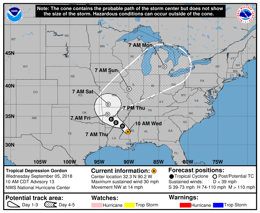
Future tropical storm Gordon forecast path and track
In terms of the sea surface temperatures that future tropical storm Gordon will traverse, at the moment the Gulf holds ample warmth for a tropical storm to intensify, with temperatures in the high 20’s and currently above the mean. However conditions are not ideal for rapid intensification currently, according to meteorologists, but that could of course change.
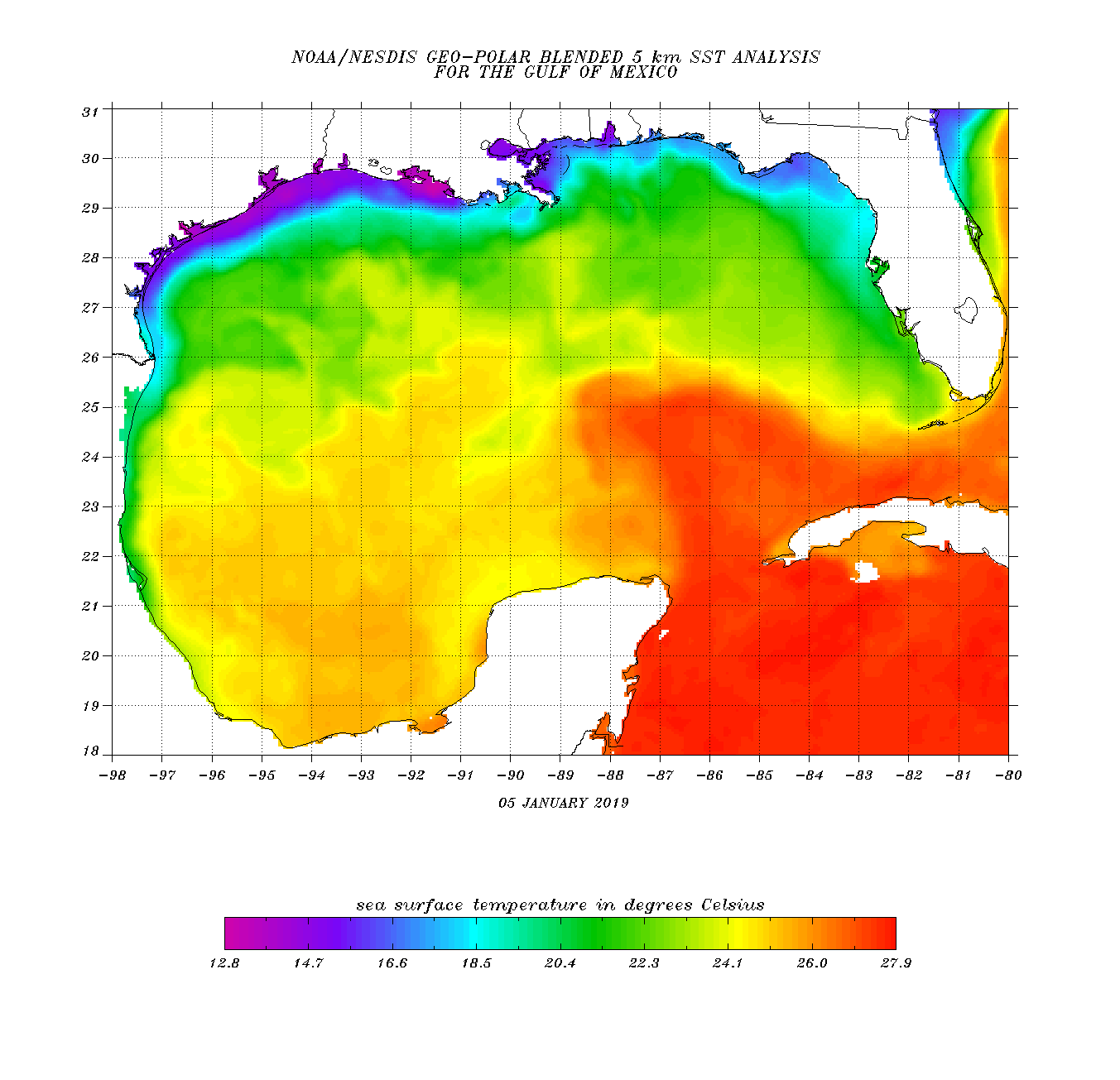
Gulf of Mexico surface temperature map
Gordon will be the latest tropical storm threat to U.S. land of the 2018 season and could result in some impacts for insurance or reinsurance interests, with flooding from rainfall and perhaps storm surge anticipated to be the major causes at this time.
At the moment NOAA is warning of storm surges up to 4 foot in height, while the risk of heavy rainfall will be highest around the landfall area and amounts of 8 inches or more are anticipated in isolated areas.
Florida is expected to feel tropical rainfall today from seven as it moves across the Keys into the Gulf proper, but it is the rainfall totals for the Gulf coast and inland that need to be watched.
That rainfall total number will likely rise as tropical storm Gordon crosses the warm Gulf waters and picks up additional moisture on its way towards a coastal landfall around the mouth of the Mississippi. Some weather watchers are talking about a plume of tropical moisture that could result in downpours of between 1 to 3 inches of rainfall per hour, which may cause significant flooding both in coastal areas and further inland as Gordon transitions back to a depression.
At the moment wind related damage is not the mair threat, which insurance and reinsurance interests will be pleased to know. But some uncertainty over the potential for tropical storm Gordon to intensify remains and there is a chance that the storm could intensify more rapidly than thought once it achieves circulation over the warm Gulf of Mexico waters.

Tropical storm Gordon wind speed intensity model guidance (from TropicalTidbits.com)
As the chart above shows tropical storm Gordon is forecast to intensify, and now a few more model runs are showing it reaching hurricane strength than there were earlier today.
Tropical storm Gordon is certainly one that insurance and reinsurance interests should watch over the coming day or so, by which time greater certainty should exist over its potential to intensify further.
Keep track of our 2018 Atlantic Hurricane Season page where our tracking map and related data is updated regularly.
![]() View all of our Artemis Live video interviews and subscribe to our podcast.
View all of our Artemis Live video interviews and subscribe to our podcast.
All of our Artemis Live insurance-linked securities (ILS), catastrophe bonds and reinsurance video content and video interviews can be accessed online.
Our Artemis Live podcast can be subscribed to using the typical podcast services providers, including Apple, Google, Spotify and more.


