


A number of weather forecast models are indicating that the Gulf of Mexico may come alive with hurricane activity later this month, as tropical disturbance 98L is expected to become a storm and then a hurricane on its path to the Gulf, with a US landfall seen as a likely outcome.
It’s important to note that these forecasts are looking a long way out and much can change over the next week to ten days. Hence, uncertainty over longer-range forecasts tends to be high.
But, right now, numerous forecast models are predicting a hurricane in the Gulf of Mexico, or close to Florida, with a high-potential for a US landfall event occurring towards the end of this month, so this is notable for insurance, reinsurance and insurance-linked securities (ILS) market interests.
It seems likely that tropical disturbance 98L will be named tropical storm Hermine (or perhaps Ian) within a few days at most, since Gaston has now been taken by a storm further north in the Atlantic.
As this system 98L heads towards the southern Windward islands, it is given a 70% chance of being named tropical storm Hermine (or Ian) within 48 hours, a 90% chance within five days.
This storm system, likely tropical storm Hermine / Ian, will then head into the Caribbean proper, where very warm seas should fuel its intensification as it heads north west towards the Gulf.
The models diverge on a final solution, while some don’t even run that far ahead to suggest where a landfall could occur. Scenarios range from the mid-Gulf Coast, to western Florida up near the Panhandle, while a more direct Florida peninsula landfall is also in some model forecasts.
Here’s a GFS ensemble model image from TropicalTidbits.com:

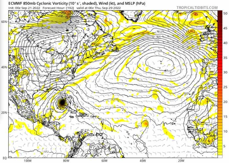
Below you can see the latest modelled intensity guidance for 98L, also from TropicalTidbits.com:

The models are suggesting intensification, as the above shows, with a hurricane seen as likely.
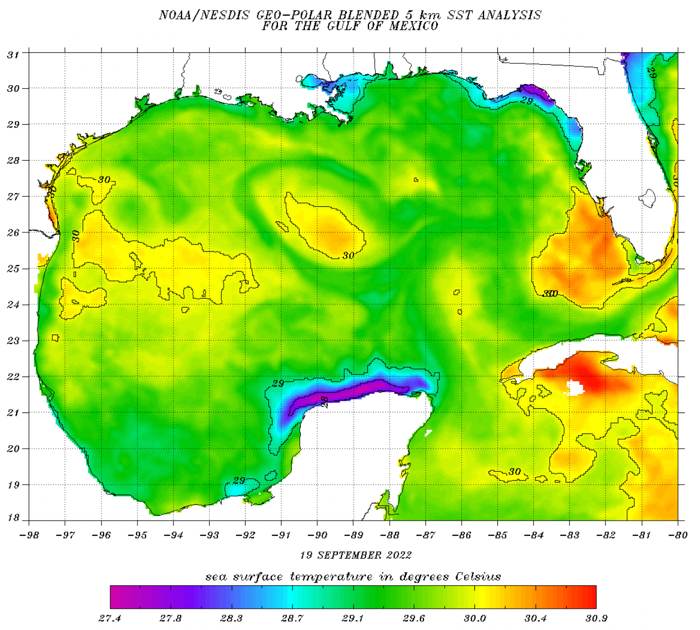
Currently the Gulf of Mexico waters are very warm, plenty warm enough for a major hurricane if any storm can enter the Gulf and the wind shear remains low enough for it to really feed off the sea temperatures as it moves towards the United States.
In fact, the Gulf of Mexico looks to be widely 29 degrees C or warmer, so SST’s are extremely supportive of an intensifying hurricane, should Hermine or Ian (whichever it is named), follow the models current forecast path.
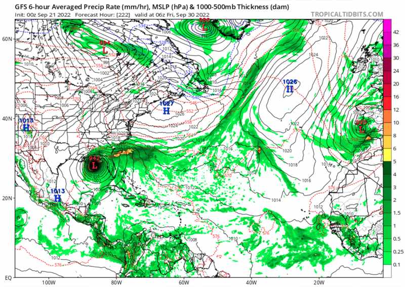
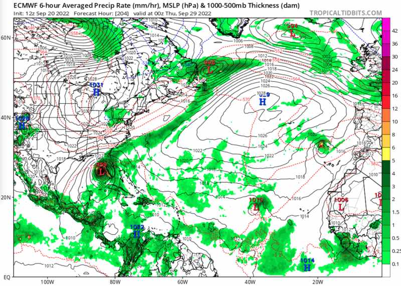
Now, onto the forecast models. Here we reproduce a number of model outputs from the last day, using TropicalTidbits.com’s excellent service.
As you’ll see, the models are in relative agreement over the potential for 98L to intensify, head generally in the direction of the Gulf of Mexico, likely as a hurricane, and also for the US coastline to face a landfall threat later this month.
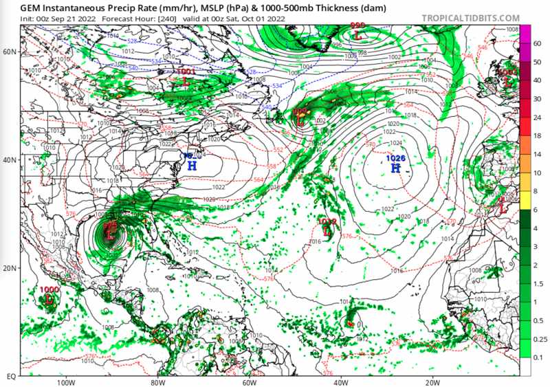
First, the GFS model which shows a relatively strong hurricane approaching landfall in the Gulf Coast / Florida Panhandle region right at the end of September:
Next, the ECMWF which at the moment is relatively close to consensus with the GFS, but suggests a west coast Florida Peninsula landfall currently:
Next, the EC-Fast model, which suggests a landfall further south in west coast Florida:
Now, the CMC model, which opts for a further west solution, with a central Gulf Coast landfall forecast:
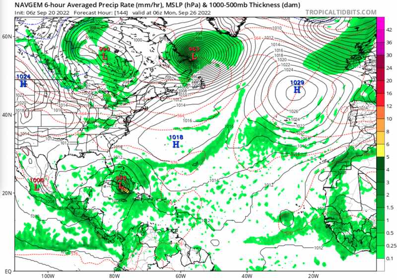
Moving on to the NAVGEM model output, which is the only one of the models we looked at not to favour a passage into the Gulf, for now:
After which we looked at the ICON model, which as far ahead as it will run shows a passage into the central Gulf as its preferred outcome:
![]()
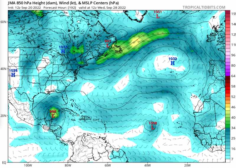
Finally, the JMA model output, which also won’t run far enough to take eventual storm or hurricane Hermine / Ian to landfall, but also suggests a Gulf of Mexico storm at the end of the month:
So, there’s a surprising amount of consensus at the moment, but of course this could all change and in a few runs time we could see wildly different scenarios predicted.
But, with the level of consensus in a Gulf of Mexico hurricane and potential US landfall on the Gulf Coast or in Florida, we felt it was worth providing some advance views of what these models are currently showing.
Whether it comes to pass or not, these models suggest the insurance, reinsurance and ILS fund community are likely to need to watch 98L closely as it likely develops into tropical storm Hermine or Ian and potentially hurricane Hermine or Ian in future.
Track the 2022 Atlantic tropical storm and hurricane season on our dedicated page and we’ll update you as new information emerges.
![]() View all of our Artemis Live video interviews and subscribe to our podcast.
View all of our Artemis Live video interviews and subscribe to our podcast.
All of our Artemis Live insurance-linked securities (ILS), catastrophe bonds and reinsurance video content and video interviews can be accessed online.
Our Artemis Live podcast can be subscribed to using the typical podcast services providers, including Apple, Google, Spotify and more.


