


Given the fact that sea surface temperatures in parts of the Atlantic are running below normal there is a chance that the basin-wide hurricane forecasts for 2018 could be reduced rather than raised at their next updates, according to JLT Re.
 The reinsurance brokers catastrophe analytics team looked at the outlook for the 2018 Atlantic hurricane season and found that “unseasonably cold waters currently positioned across the tropical Atlantic and Caribbean” are likely to lead forecasters to reduce their outlooks for the season.
“As the next set of forecasts come out in early June, it is likely that forecasts will be reduced vs. raised in terms of basin wide activity expectations for the season,” JLT Re explained.
In fact, JLT Re highlights that if Atlantic SSTs remain at their current anomalously cold levels for the rest of May, this could be coldest May water temperatures in the tropical Atlantic since 1994 and slightly colder than 2002. Both of those years hurricane seasons saw below average hurricane counts in the Atlantic with 3 and 4 storms, respectively.
Adding, “There is also some possibility of a developing El Nino by the latter portion of the season; the tropical Pacific is currently in a neutral state. El Nino conditions increase wind shear and provide a more hostile environment for tropical development.”
The current forecast is for neutral ENSO conditions to continue to the end of this year’s hurricane season and then transition towards El Nino next year, but should that change sooner it could add another factor that points towards a more average hurricane season and perhaps a lower chance of storms being steered towards the coastal United States.
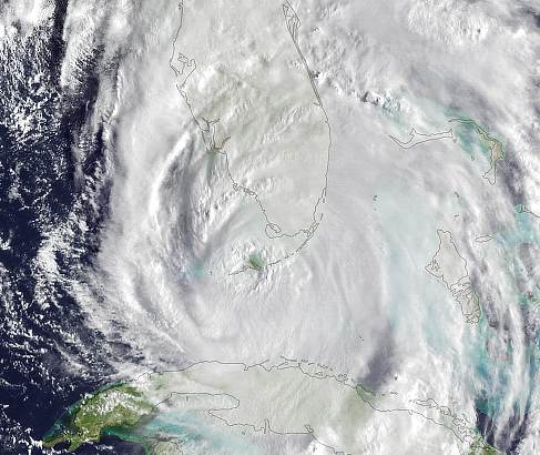
On the other hand, the Gulf of Mexico currently has above average sea surface temperatures and has already been pointed to for potential tropical development this week, as a disturbance has been given a 60% chance of becoming a pre-hurricane season named storm.
As a result, the National Hurricane Center has said there is a 60% likelihood of tropical storm formation through the coming weekend, which if it occurs would result in an early Alberto.
If tropical storm Alberto does form this weekend it would be expected to landfall in the Gulf as a tropical storm, so not with significant winds. However rainfall could be an issue, and plumes of tropical moisture are expected to extend across Florida and other areas through the coming days.
Our Artemis average forecast for the 2018 Atlantic hurricane season from the list of meteorological organisations we track remains for 14 named storms, 7 hurricanes and 3 major hurricanes.
Of course storm numbers are not what matters, it is intensity and where they are steered that drives the potential for insurance, reinsurance and ILS market losses.
Register now for our upcoming ILS conference. Tickets on sale here.

![]() View all of our Artemis Live video interviews and subscribe to our podcast.
View all of our Artemis Live video interviews and subscribe to our podcast.
All of our Artemis Live insurance-linked securities (ILS), catastrophe bonds and reinsurance video content and video interviews can be accessed online.
Our Artemis Live podcast can be subscribed to using the typical podcast services providers, including Apple, Google, Spotify and more.


